


A staggering 25% of the United States' most critical infrastructure is at risk for flooding, according to an alarming new report released Monday.
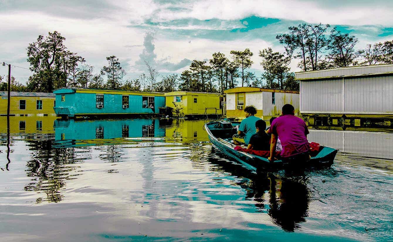
The report, titled "The Third National Flood Risk Assessment: Infrastructure on the Brink," examines how various types of water-based danger — including flash flooding, coastal flooding, and life-threatening storm surges from the ocean — specifically threaten different parts of the country. The data reveals four states where that threat is the highest: Louisiana, Florida, Kentucky, and West Virginia.
Here's what you need to know about the report, which was prepared by First Street Foundation, a nonprofit research firm based in Brooklyn, New York.
What U.S. cities are at the highest risk for flooding?
Balancing the risks of flooding as it applies to roads, critical infrastructure, and residential and commercial properties, the report identifies these cities as being in the most danger:
- Metairie, LA
- New Orleans, LA
- Cape Coral, FL
- Stockton, CA
- Fort Lauderdale, FL
- Sacramento, CA
- Charleston, SC
- Miami, FL
- North Port, FL
- Chattanooga, TN
- Eugene, OR
- St. Petersburg, FL
- Santa Rosa, CA
- Tampa, FL
- Mobile, AL
- Houston, TX
- Lake Charles, LA
- Hampton, VA
- Fresno, CA
- Palm Coast, FL
What specifically is at risk in these areas?
Th report's "critical infrastructure" category includes things like airports, utilities, and emergency services (such as law enforcement, fire departments, and hospitals). The study also considers how flooding would effect residential and commercial properties, as well as roadways and "social infrastructure" like schools and government buildings.
The report examines how the flood risk for these categories will change over the next 30 years. The research shows that by 2051, "an additional 1.2 million residential properties, 66,000 commercial properties, 63,000 miles of roads, 6,100 pieces of social infrastructure and 2,000 pieces of crucial infrastructure also will have flood risk that would render them inoperable, inaccessible or impassable," according to analysis by USA Today.
Why is the danger of flooding on the rise?
There are a number of factors, which the report splits up based on geographical location.
Along the coasts of the Atlantic Ocean and the Gulf of Mexico, "risk increases almost universally due to associations with the forecasted increases in sea-level rise; increases in surge due to the forecasts of stronger coastal
storm intensities; and increases in latitudinal reach of coastal storms due to a warming atmosphere and ocean," the report explains.
In the Northwest, the leading factors include rising levels of rain, runoff during and after storms, and melting snow in locations that feed the region's rivers.
The risk for flooding is much less pronounced in landlocked portions of the country, stretching from Iowa to New Mexico, partly because those areas are forecasted to receive less rainfall in the 30-year period the report examines.
If you're alarmed by how many of these factors can be traced back to climate change, check our our primers on how global warming really affects humans' health, as well as what individuals can do to make a difference.