


Hurricane Ian smashed into Florida on Wednesday, where it unleashed catastrophic floods and life-threatening storm surges. Here's the latest on one of the most powerful storms to hit the U.S. in decades.
Ian barrels toward South Carolina
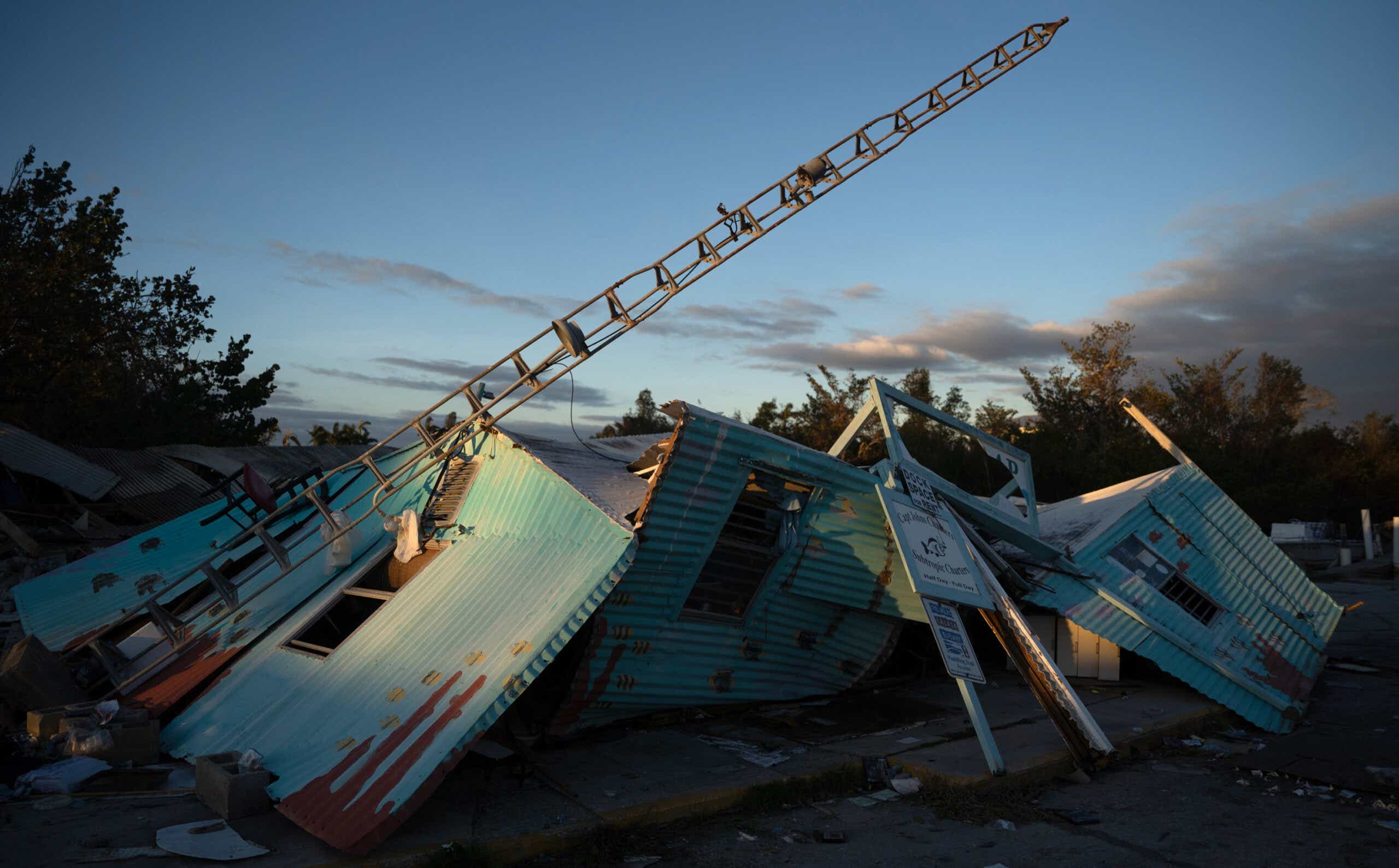
As of Friday morning, Hurricane Ian is heading toward South Carolina as a Category 1 storm. Ian has claimed at least 19 lives in the U.S. so far, including at least a dozen in Florida, where nearly 2.2 million people are still without power. The flooding and structural damage across the state are seriously hampering repair and search and rescue efforts, and many buildings in Fort Myers have all but vanished.
Residents who chose not to evacuate are being warned to avoid power lines that are mixed inside fallen trees, and beware of potentially electrified standing water.
Ian is expected to arrive in South Carolina around midday, when the high tide may exacerbate storm surges. Per CNN, the high tide in Charleston, which is particularly vulnerable to coastal flooding, is at 11:41 a.m. ET. High tide in Myrtle Beach is at 11:18 a.m. ET.
A megastorm
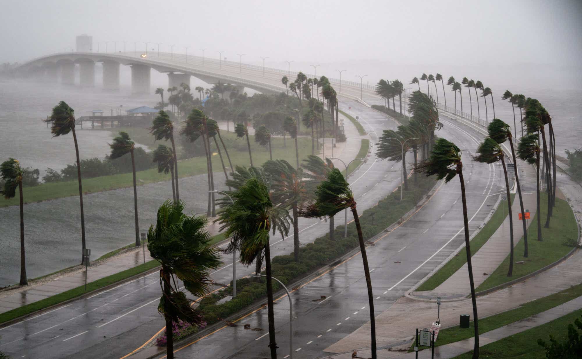
Ian made landfall on the Gulf Coast on Wednesday as a Category 4 storm packing 150 mph sustained winds and knocking out power for more than 2.3 million homes and businesses. As of early Thursday, it had weakened to a Category 1 storm, but conditions were still seriously dangerous, with some areas set to see their worst storm surges on record.
Governor Ron DeSantis urged those who hadn't made it to the shelters to avoid roads and take cover at home.

“It’s time to hunker down and prepare for the storm,” he said before Ian landed. “Do what you need to do to stay safe. If you are where that storm is approaching, you’re already in hazardous conditions. It’s going to get a lot worse very quickly.”
DeSantis has reportedly been in regular contact with President Biden this week. He says some areas have already seen 12-foot storm surges.
"This is a big one, and I think we all know there’s going to be major, major impacts," he said per NBC. "We have a long way to go before the storm exits this state."
"Turn around, don't drown"
Flash flood warnings have been active in parts of Osceola County and Orange County. Drivers have been warned to be especially cautious at night, and avoid flooded roads. The Orlando metro area received between 8 to 12 inches of rain on Wednesday, and storm surge warnings have been in effect for Suwannee River southward to Flamingo, Tampa Bay, the Flagler/Volusia Line to the mouth of the South Santee River, and St. Johns River.
The National Hurricane Center warned: "This is a life-threatening situation. Persons located within these areas should take all necessary actions to protect life and property from rising water and the potential for other dangerous conditions. Promptly follow evacuation and other instructions from local officials."
Fort Myers underwater
One holidaymaker in Fort Myers told NBC that she looked out of her condo window and saw her car "float away."
A TV news station in the same area, WINK TV, was flooded on Wednesday night. WINK's Chief Meteorologist Matt Devitt posted a video of the high water inside the building, and WINK Chief Meteorologist Matt Devitt wrote: “Storm surge got into WINK, flooded out our entire set and newsroom in Fort Myers. Lost power and I was unable to continue broadcasting on tv and radio.”
“Storm surge and a flood brought by Hurricane Ian has interrupted the WINK News broadcast. The power went out just before 5 p.m., but anchors Lois Thomas and Chris Cifatte and Chief Meteorologist Matt Devitt continued to broadcast on Facebook for a period of time,” according to an update on the station's website.
Weakened, but still powerful
The National Hurricane Center said that hurricane and tropical storm warnings had been dropped across southern Florida as Ian moved farther north, but as of Thursday it remained a Category 1 storm with sustained winds of up to 75 mph.
”Further weakening is expected for the next day or so, but Ian could be near hurricane strength when it moves over the Florida East coast later today,” it explained.
Ian's anticipated path
Georgia, South Carolina, North Carolina and Virginia are all under states of emergency as they await Hurricane Ian's arrival. Ian is expected to head toward those states as a tropical storm and probably dump flood levels of rain after it passes over Florida.